

Survey-Grade Drone Data Services for Infrastructure Projects
Delivering accurate, compliant, and engineering-ready data across mapping, inspection, and analysis workflows.

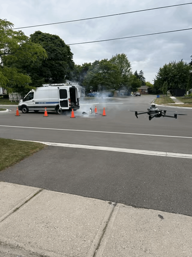
Autonomous Waypoint Missions Flights
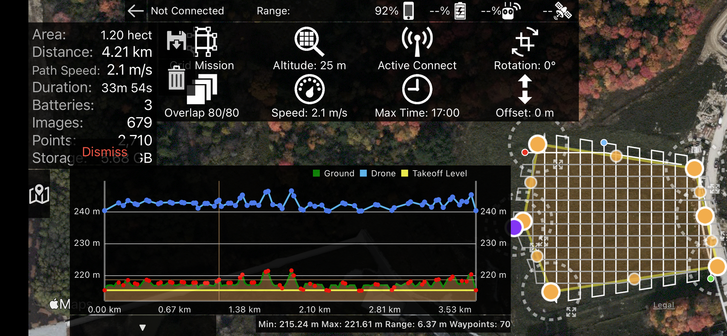
Autonomous Orthomosaic and 3D model flights
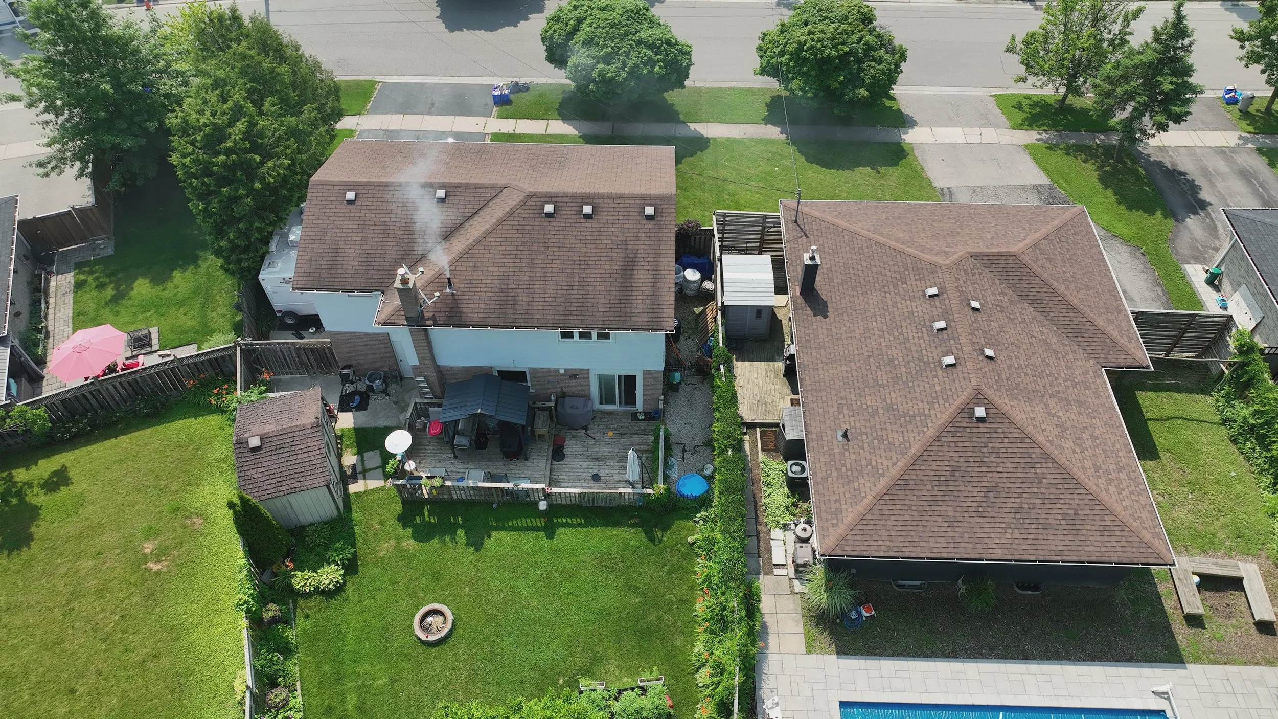
Construction Monitoring & Progress Tracking
Drone Plan provides consistent, repeatable site monitoring to track construction progress over time.
High-resolution imagery, orthomosaics, and 3D models allow project teams to assess site conditions, verify progress, and identify issues early.
Deliverables are structured for reporting and integrated into CAD, GIS, and project management workflows—supporting informed decision-making throughout the project lifecycle.
Utility & Infrastructure Inspections
Aerial inspections provide safe, efficient visibility into infrastructure assets, including transmission lines, corridors, and hard-to-access locations.
Drone Plan captures detailed, high-resolution imagery and spatial data to identify defects, assess conditions, and support maintenance planning.
Field-to-GIS integration ensures inspection data aligns with existing asset management systems.


LiDAR Data Acquisition
Drone LiDAR provides high-accuracy terrain and surface data in complex environments, including areas with vegetation or limited visibility.
Outputs include classified point clouds, digital terrain models (DTMs), and digital surface models (DSMs), enabling detailed analysis and engineering design.
Drone Plan delivers LiDAR datasets structured for direct use in CAD, GIS, and infrastructure planning workflows.


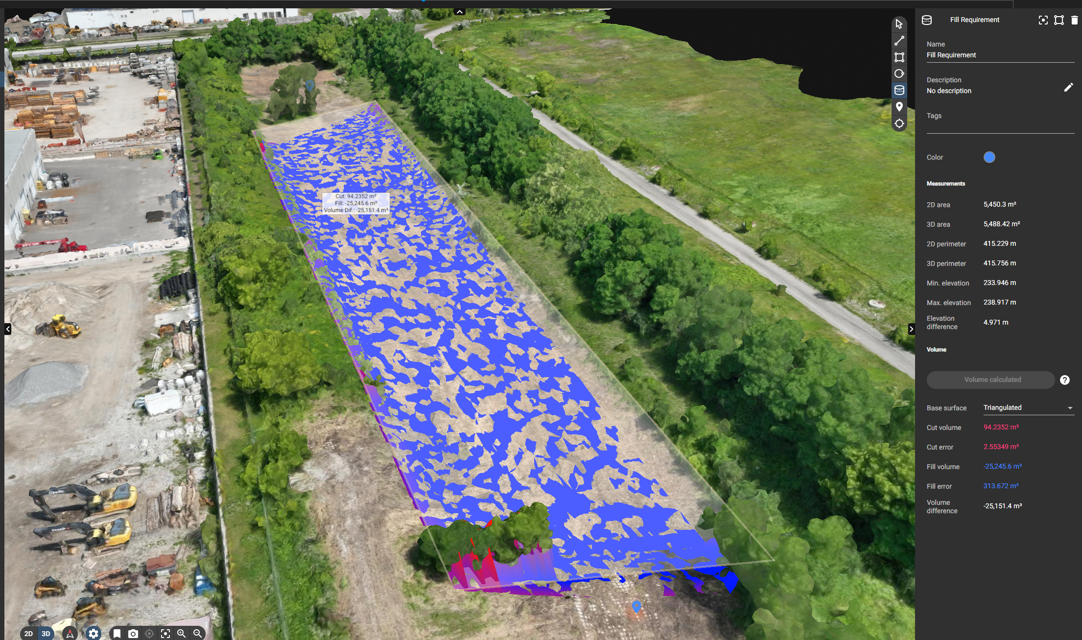
Cut & Fill Estimates
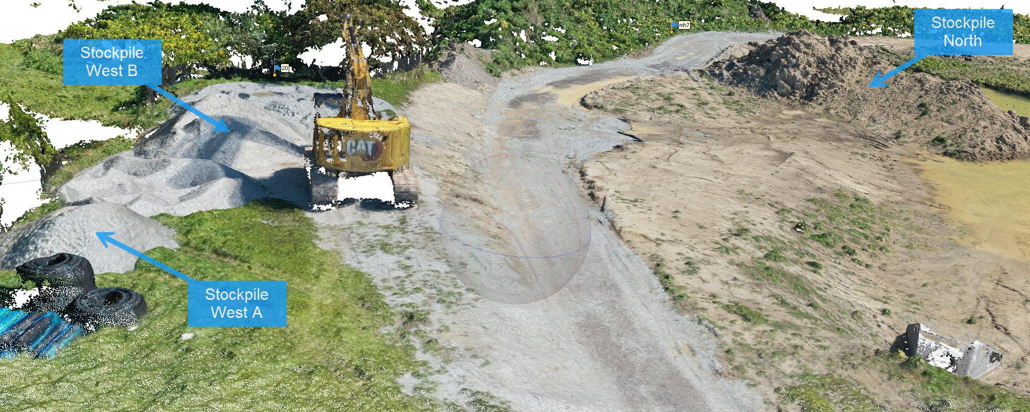
Point Cloud 3D Visualization of Stockpiles

Stockpile Volume Tracking

GCP (Ground Control Point) Accuracy Report

Stockpile Volume Estimates
Volumetric Surveys & Reporting
Drone-based volumetric analysis provides accurate measurements of stockpiles, excavation areas, and site grading.
High-resolution data enables precise cut-and-fill calculations, volume tracking, and reporting for construction and material management.
Results are audit-ready and structured for engineering review and project documentation.
Dynamic Site Monitoring
Scheduled drone flights enable consistent monitoring of site conditions over time, providing a clear visual and data-driven record of progress.
This supports change detection, documentation, and coordination across project stakeholders.
Data outputs are standardized to ensure comparability across reporting periods.


Change Detection & Site Comparison
Before-and-after datasets enable direct comparison of site conditions across time, supporting project verification, documentation, and reporting.
These comparisons help quantify progress, validate work completed, and provide clear visual communication for stakeholders.
Visual Documentation & Project Visualization
Drone Plan provides high-quality visual documentation to support project communication, stakeholder reporting, and site understanding.
Aerial video and visualizations enhance clarity and provide context alongside engineering data deliverables.
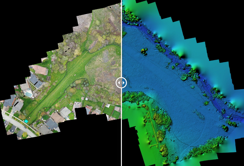
Orthomosaic & Digital Elevation/Surface Model
Orthomosaic imagery and elevation models provide georeferenced, high-resolution representations of site conditions.
These outputs support design, analysis, and planning by delivering accurate spatial context and terrain data.
Combined datasets provide a comprehensive understanding of site topography for engineering applications.
3D Model (Digital Twin)
3D models provide accurate, data-driven representations of real-world conditions.
These models support visualization, analysis, and planning, enabling teams to better understand site conditions and make informed decisions.
Outputs are compatible with engineering, GIS, and asset management systems.
Existing Site Conditions
Completed Site Conditions


GIS Services
Drone Plan delivers GIS integration services that ensure drone data aligns with existing spatial systems and workflows.
Deliverables are structured for use within GIS platforms, supporting analysis, visualization, and long-term asset management.
With over 25 years of GIS experience, Drone Plan ensures data consistency, accuracy, and usability across all projects.
Supporting Municipal and Infrastructure Projects Across the GTA
Drone Plan delivers survey-grade data solutions aligned with engineering, construction, and asset management requirements.
